
People around the world are helping scientists in the fight against climate change by photographing this year's incredible, extreme high tides

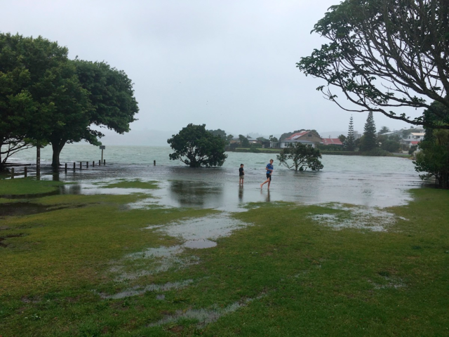
A few times a year, when the orbits and alignment of the Earth, moon, and sun combine, so-called "king tides" are produced.

"King tides" is a non-scientific term that is used to describe exceptionally high tides of water. They can cause tidal flooding.
Source: National Ocean Service
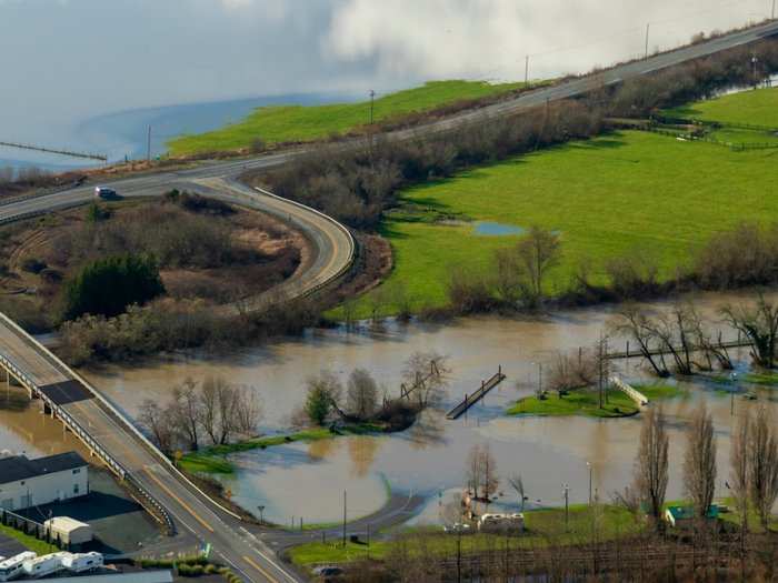
The flooding which is caused by high tides is always a good marker for how the sea level rise will affect coastal communities.
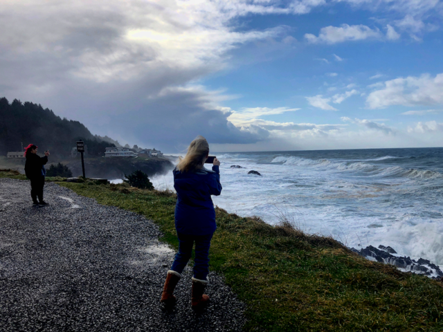
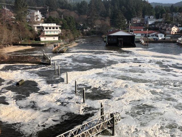
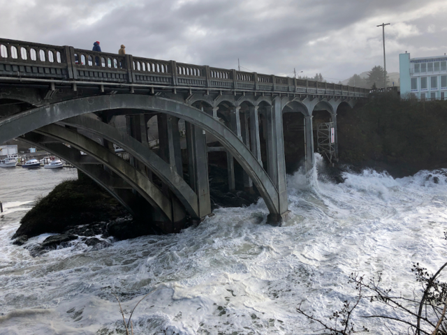
If paired with bad weather, the king tides can create major waves and stormy conditions. Earlier this year, 15-to-20-foot waves in Oregon sucked a man and two young children into the sea.
A woman who was taking pictures of the tides from her house called 911, but the children, aged 4 and 7, both died.
Source: Associated Press, KDRV
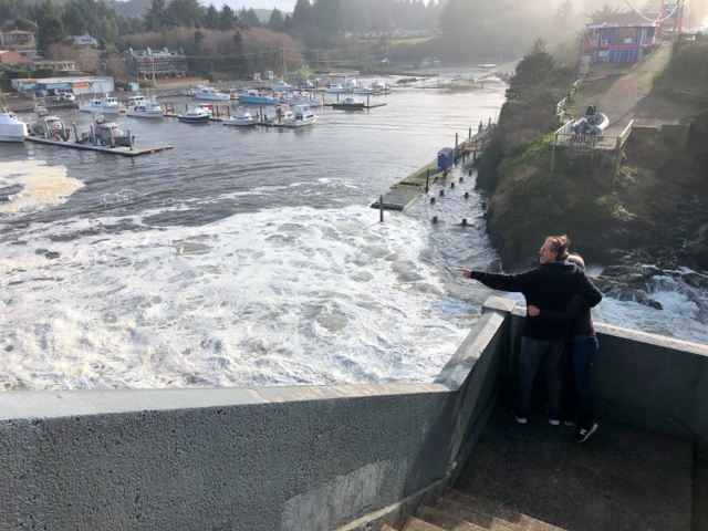
To monitor the flooding, a group of volunteer photographers and scientists teamed up to launch the King Tide Project.
The first King Tide Project launched in 2009 in Australia but it has since spread to New Zealand, Mauritius, coastal states in the US and British Columbia.
Source: Associated Press
The idea behind the project is to collect as many pictures of king tides around the world as possible so that scientists, policymakers, and even city planners can study and prepare for the effects of climate change.

"A lot of the conversation around climate change was what was happening far away and not about what people were going to be experiencing in their own lives," one of the founders of the project, Marina Psaros told AP.
"The goal of the project was to get people thinking more about climate change locally instead of just polar bears."
Source: Associated Press
The photos are valuable in showing where flooding can occur on specific roads as well as where it is safe to build new housing.
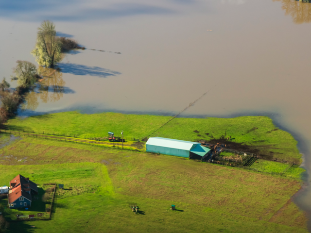
Over time, the pictures show what exact parts of the world are most in danger, whether flooding might occur, or an increase in sea levels.
Source: Associated Press
Any pictures taken of the extreme high tides can be uploaded with geolocation data embedded on the King Tides Project's website.
There is now even a smartphone app for the project, that makes crowdsourcing images much easier.
Source: King Tides Project, Associated Press
In Auckland, New Zealand one year, images sent in by people of flooded parks and freeway underpasses, were used by local government to develop a new plan to reinforce a popular, but rapidly eroding beach.
"There's no eureka moment where it all comes into play, but it's an evolving database of information that's there when needed," founder of the New Zealand King Tide Project, Ben Sheeran said.
Source: Associated Press
This year, scientists, volunteers, and observers documented the winter's final high tide, which occurred off the U.S West Coast on February 8, 9, and 10. They are also preparing to capture more pictures in New Zealand on February 12.
"Seeing [so much water] over such a large area, it really opened my eyes," Olson said. "This is impactful," one volunteer said.
Source: Associated Press
 Next Story
 I tutor the children of some of Dubai's richest people. One of them paid me $3,000 to do his homework.
 A 13-year-old girl helped unearth an ancient Roman town. She's finally getting credit for it over 90 years later.
 It's been a year since I graduated from college, and I still live at home. My therapist says I have post-graduation depression.
 Employment could rise by 22% by 2028 as India targets $5 trillion economy goal: Employment outlook report
 Patanjali ads case: Supreme Court asks Ramdev, Balkrishna to issue public apology; says not letting them off hook yet
 Dhoni goes electric: Former team India captain invests in affordable e-bike start-up EMotorad
 Manali in 2024: discover the top 10 must-have experiences
 RCB's Glenn Maxwell takes a "mental and physical" break from IPL 2024
