20 images that show how much we've reshaped planet Earth in the past 70 years
Photographs from the 1940s to the 2000s show the drastic impact of climate change on our planet's glaciers. Here is a photo of Alaska's Muir Glacier, pictured in August 1941 (left) and August 2004 (right).

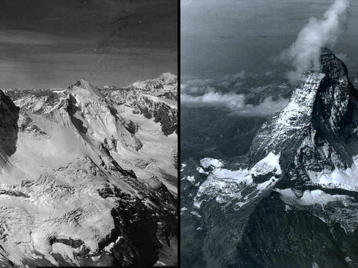
Here's the snow that remained on Matterhorn Mountain in Switzerland in August 1960 (left), compared with August 2005 (right).
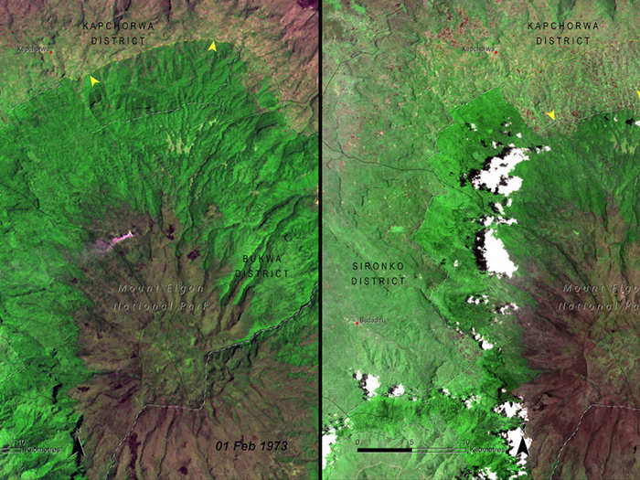
Starting in the 1970s, NASA began using satellite images to document deforestation in several national parks around the world. Here's Mount Elgon National Park in Uganda in 1973 (left), compared with the park in 2005 (right).
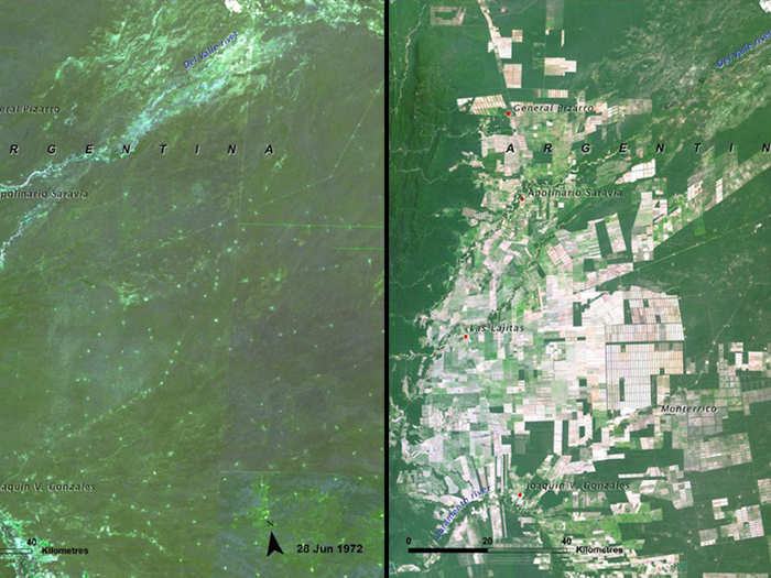
The deforestation of Argentina's Salta Forest is starkly visible in this pair of photos from 1972 (left) and 2009 (right).
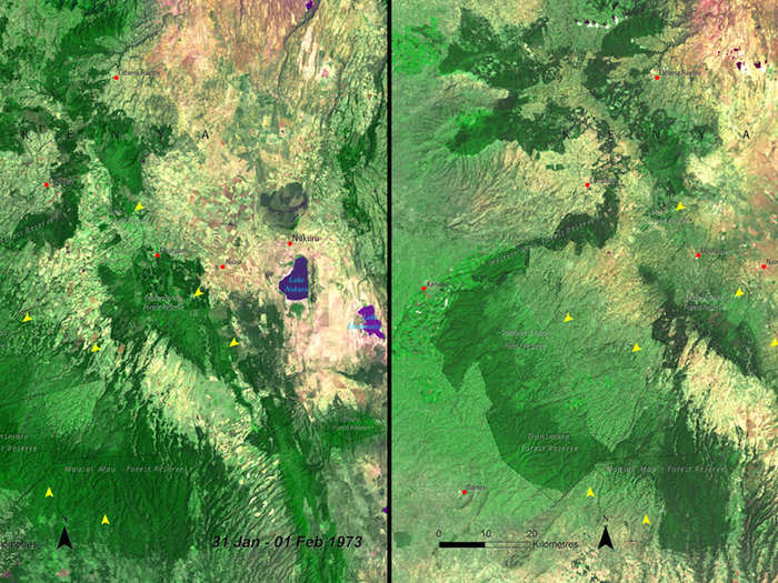
More deforestation is visible in Kenya's Mau Forest in these photos from January 1973 (left) and December 2009 (right).
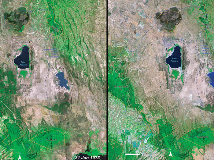
A similar story applies to Kenya's Lake Nakuru National Park, shown here in 1973 (left) and 2000 (right).
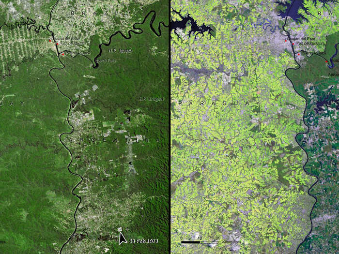
Deforestation is also prevalent in the South American Atlantic Forest in Paraguay — here's how it looked in 1973 (left) versus 2008 (right).
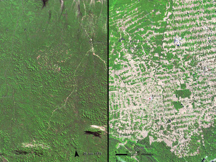
This area of Rondonia, Brazil was heavily deforested between 1975 (left) and 2009 (right).
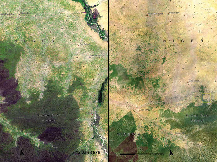
So was the Baban Rafi Forest in Niger, from 1976 (left) to 2007 (right).
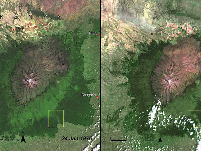
These images show the deforestation of Mount Kenya Forest in Kenya, 1976 (left) vs. 2007 (right).
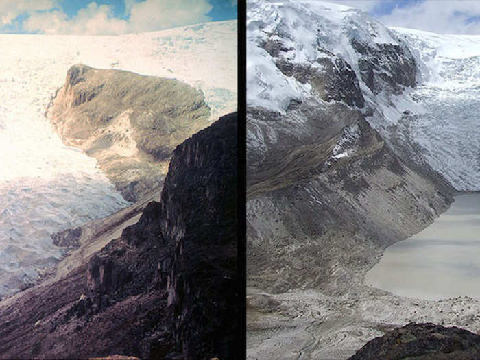
Climate change began to take a more extreme toll on glaciers in the 1970s as well. Here is a photo of Qori Kalis Glacier in Peru in 1978 (left) and again in 2011 (right).
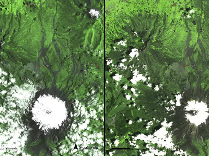
These images document melting ice in Ecuador, from March 1986 (left) to February 2007 (right).
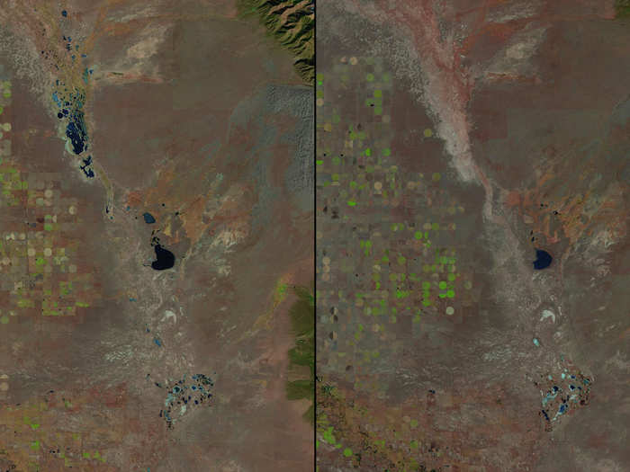
Beginning in the 1980s, NASA also documented shrinking lakes across the globe, starting with this photo of Great Sand Dunes National Park in Colorado in 1987 (left). The same park is shown in 2011 (right).
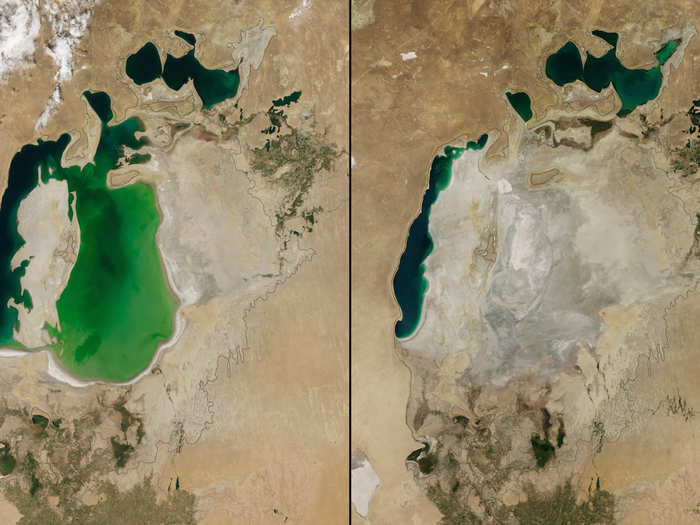
The Aral Sea in Central Asia shrunk drastically between 2000 (left) and 2014 (right).
So did the Elephant Butte Reservoir in New Mexico. Here it is in 1994 (left) and again in 2013 (right).

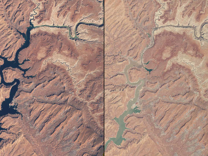
Rivers have been shrinking in Arizona and Utah as well — these images compare them in March 1999 (left) and May 2014 (right).
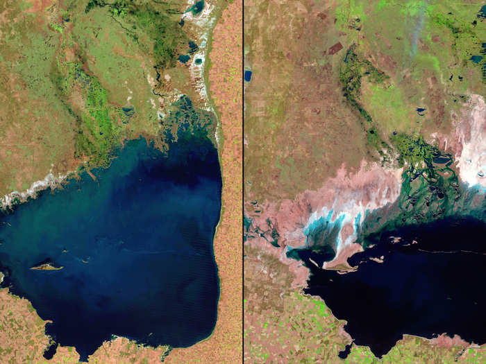
Argentina's Mar Chiquita Lake shrunk significantly from 1998 (left) to 2011 (right).
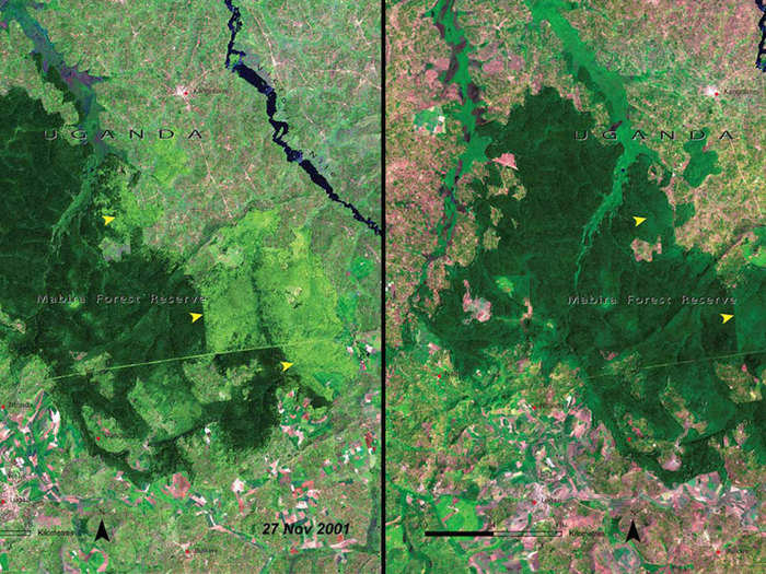
And deforestation continued to take a toll as time went on, as evidenced by this pair of images of the Mabira Forest in Uganda in 2001 (left) and the same area just 5 years later (right).
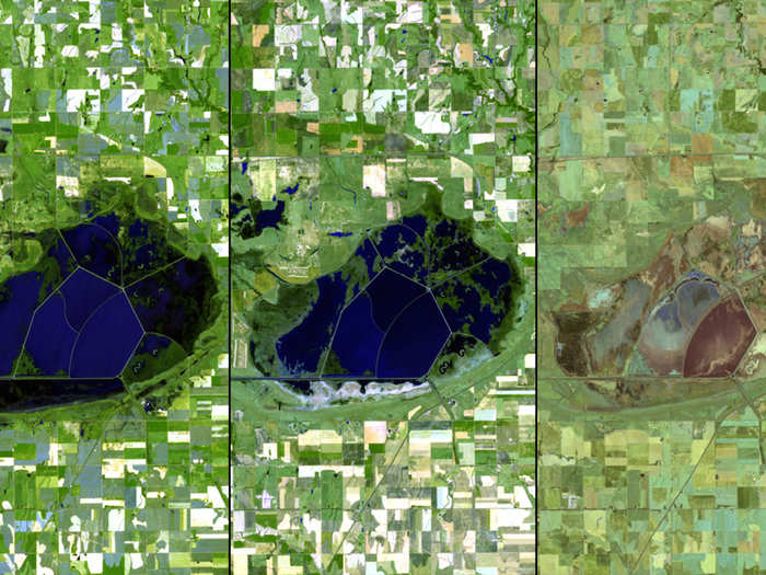
Droughts have affected the US intensely over the past few years as well. Here are three images of water drying up in Kansas, taken in 2010 (left), 2011 (middle), and 2012 (right).
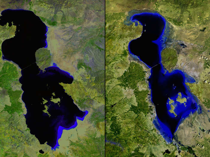
Iran's shrinking Lake Urmia is pictured below in July 2000 (left) and again in the same month in 2013 (right).
Popular Right Now
Advertisement