It was a devastating summer for the Arctic.
In September, sea ice in the Arctic Ocean hit a low of about 1.4 million acres – the second-lowest on record, according to data from the National Snow and Ice Data Center. The only time it got lower was in 2012, when ice cover reached over just 1.3 million acres.
In the 1980s, ice covered at least 1 million more acres of ocean than it does now. In 1980, its minimum extent was 2.7 million square miles, according to NASA.
When it comes to ice on land, the picture is just as dire. Greenland is on track to lose more of its ice sheet this century than any other in the past 12,000 years, according to a recent study published in the journal Nature.
Weather patterns, like seasonal changes in atmospheric pressure, play a role in fluctuations in ice cover and loss. But climate change has overwhelmingly driven the dramatic increase in melting observed over the last 40 years.
"Absolutely we're seeing climate change at work because the warm summers become warmer and the cold winters aren't as cold as they were," Mark Serreze, director of the Snow and Ice Data Center, told the Associated Press.
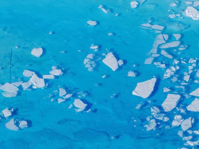
The following 11 images reveal how melting ice has transformed the Arctic region.

 Colon cancer rates are rising in young people. If you have two symptoms you should get a colonoscopy, a GI oncologist says.
 I spent $2,000 for 7 nights in a 179-square-foot room on one of the world's largest cruise ships. Take a look inside my cabin.
 An Ambani disruption in OTT: At just ₹1 per day, you can now enjoy ad-free content on JioCinema
 In second consecutive week of decline, forex kitty drops $2.28 bn to $640.33 bn
 SBI Life Q4 profit rises 4% to ₹811 crore
 IMD predicts severe heatwave conditions over East, South Peninsular India for next five days

 Next Story