The Indian Space Research Organisation (ISRO) has planned a public release of this data from Chandrayaan 2 in October.
This is the same data that the Indian space agency is already using to create the highest resolution 3D map of the Moon.
The data packet will include insights from all eight of the orbiter’s instruments.
Advertisement
The Indian Space Research Organisation (ISRO) has announced that it will be publicly releasing all the science data from Chandrayaan-2 for global use. And, this includes the images that went behind creating the highest-resolution 3D map of the Moon.
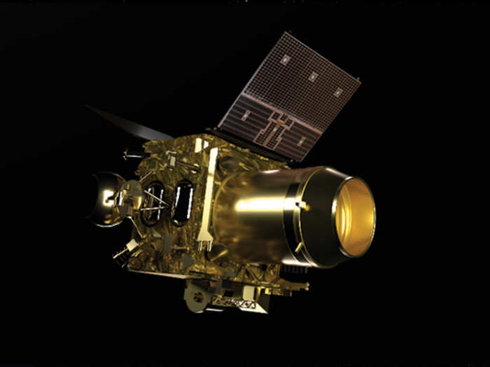
The orbiter is home to eight out of the 14 payloads, or instruments, that were aboard Chandrayaan-2 when it took off from Earth. Even though Vikram — Chandrayaan 2’s lander — didn’t make it, the orbiter has still been looking high and low for new discoveries, including the presence of water.
3D view of crater near Lindbergh. The triplet images from TMC-2 when processed into Digital Elevation Models, enable mapping of surface landform morphologies. ISRO
ISRO’s highest resolution 3D map of the Moon The Indian space agency’s initial plans to release the data were scrapped when the 51st Lunar and Planetary Science Conference in March was cancelled due to the coronavirus outbreak.
Instead, it released the draft of one of the projects that it was working — the highest resolution 3D map of the Moon. The Chandrayaan 2 orbiter is using the four instruments it has onboard to capture details of what’s on and below the lunar surface.
The 3D representation of the Moon will help serve as a guide to future missions and even point out where large reserves of water or other elements are most likely to be hidden.
List of instruments onboard the Chandrayaan 2 orbiter:
Terrain Mapping Camera 2 (TMC 2)
Chandrayaan 2 Large Area Soft Spectrometer (CLASS)
The hunt for water on the Moon One of the main instruments being used to create the map is also a key payload for ISRO in its hunt for water. The Imaging IR Spectrometer (IIRS) is analysing the surface for the presence of water but it’s also mapping for minerals and volatility.
To support IIRS findings, the Dual Frequency Synthetic Aperture Radar (SAR) will be trying to provide a quantitative estimate of exactly how much is present below the surface.
Data captured by Chandrayaan's SAR instrumentISRO
Peering through the darkness Using the Orbiter High-Resolution Camera (OHRC) can capture images at 0.25 meters per pixel. The only other instruments going around the Moon that come anywhere close to the same level of accuracy is the National Aeronautics and Space Administration’s (NASA) Lunar Reconnaissance Orbiter (LRO) that can capture pictures of the Moon at 0.5 meters per pixel.
Advertisement
Close up view of boulders on the lunar surface taken by the OHRC onboard the Chandrayaan 2 orbiterISRO
What makes the data from OHRC even more unique is that it can even capture images during underlit conditions. So, when a particular region may not be illuminated by sunlight, the orbiter will still be able to peer through the darkness to capture the crater floors of the Moon.
The OHRC is working alongside the Terrain Mapping Camera (TMC 2), the Imaging Infrared Spectrometer (IIRS), and the Dual Frequency Synthetic Aperture Radar (DFSAR) to create the 3D map.
The TMC2 has an additional purpose to help scientists on Earth gain a better understanding of the Moon’s evolution.
Minerals and precious metals One of the instruments not involved in the making of the 3D map but has data of its own to offer is the Chandrayaan 2 Large Area Soft X-Ray Spectrometer (CLASS). It’s on the hunt for major elements like Aluminium, Magnesium, Silicon, Calcium, Sodium, Iron or Titanium near the Moon’s South Pole.
The Solar X-Ray Monitor (XSM) helps CLASS analyse its own data by measuring the intensity of the X-Rays emitted by the Sun and its corona.
Advertisement
Finally, the Chandrayaan 2 Atmospheric Compositional Explorer 2 (CHACE 2) has been gathering data from the lunar exosphere to carry an in-situ study of its composition and durability. SEE ALSO: ISRO to release Chandrayaan-2 data globally from October
NewsletterSIMPLY PUT - where we join the dots to inform and inspire you. Sign up for a weekly brief collating many news items into one untangled thought delivered straight to your mailbox.


 Next Story


 Global stocks rally even as Sensex, Nifty fall sharply on Friday
 In second consecutive week of decline, forex kitty drops $2.28 bn to $640.33 bn
 SBI Life Q4 profit rises 4% to ₹811 crore
 IMD predicts severe heatwave conditions over East, South Peninsular India for next five days
 COVID lockdown-related school disruptions will continue to worsen students’ exam results into the 2030s: study
