How to measure distance in Google Maps on any device to help you create a personal route
Advertisement
Dave Johnson
Oct 8, 2021, 20:36 IST
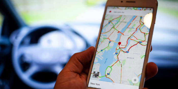
You can use a computer or mobile device to quickly measure distance in Google Maps.
Jaap Arriens/NurPhoto via Getty Images
You can measure distance on Google Maps to give you the approximate mileage between any two points (or more) that you place on the map.
When using Google Maps on a computer, right-click a spot on the map and choose Measure distance, then just click to add more points to measure the distance.
On a mobile device, you can drop a pin by tapping the screen and use the pop-up window for the pin to measure distances.
Advertisement
You may know Google Maps as the ubiquitous turn-by-turn navigation software on your phone, but it's surprising how much else you can do with the mapping software.
One handy feature is the ability to measure the real-world distance between any number of selected points. This way, you can quickly find the straight-line distance between two cities, or the approximate distance along an irregular path by placing multiple points like breadcrumbs.
How to measure distance in Google Maps on a computer
Capability development is critical for businesses who want to push the envelope of innovation.Discover how business leaders are strategizing around building talent capabilities and empowering employee transformation.Know More
2. Right-click anywhere on the map that you want to set as a starting point. In the dropdown menu, choose Measure distance.
Right-click on the map and choose "Measure distance" from the menu.
Dave Johnson
3. Click a second location on the map to find the distance to that point. At the bottom of the page, you'll see a pop-up window display the total distance so far.
Advertisement
4. If you want to measure a more complicated path, you can continue laying down additional points by clicking. After each new point, you will see the distance at the bottom of the page update.
The pop-up window at the bottom of the page shows the distance between all the points on the map.
Dave Johnson
5. When you're done, click the X to close the pop-up window at the bottom of the page.
Quick tip: You can move a point you've already added to the map - just click and drag it to the new destination. You can also remove a point by clicking it (without dragging).
How to measure distance in Google Maps on an iPhone or Android
1. Start the Google Maps app on your mobile device.
2. Tap and hold a position on the map where you'd like to start measuring. A red pin will drop.
Advertisement
Tap and hold on the map to drop a pin.
Dave Johnson
3. Tap the pop-up at the bottom of the screen for the dropped pin.
4. Tap Measure distance.
Choose Measure distance from the pin's details page.
Dave Johnson
5. When the pop-up disappears, move the map until the target is positioned over the new location where you want to measure. (Note that you're moving the map, not the point.) Then, at the bottom of the screen, tap Add point. You should see the distance in the lower left of the screen.
6. If you want to measure a longer or more complex path, you can continue adding points. To do that, move the map again and you'll see that a new line segment appears with a new target. When it's where you like, tap Add point again. After each new point, you should see the distance update.
See the distance between all points on the map at the bottom of the screen.
Dave Johnson
7. When you're done, tap the Back arrow at the top left of the screen.
Advertisement
Quick tip: You can't move a point you've already added to the map, but you can remove the most recent point by tapping the Undo button at the top of the screen. To start over, tap the three-dot menu at the top right of the screen and choose Clear.
NewsletterSIMPLY PUT - where we join the dots to inform and inspire you. Sign up for a weekly brief collating many news items into one untangled thought delivered straight to your mailbox.


 Next Story
 A couple accidentally shipped their cat in an Amazon return package. It arrived safely 6 days later, hundreds of miles away.
 A centenarian who starts her day with gentle exercise and loves walks shares 5 longevity tips, including staying single
  2 states where home prices are falling because there are too many houses and not enough buyers
 "To sit and talk in the box...!" Kohli's message to critics as RCB wrecks GT in IPL Match 45
 7 Nutritious and flavourful tiffin ideas to pack for school
 India's e-commerce market set to skyrocket as the country's digital economy surges to USD 1 Trillion by 2030
 Top 5 places to visit near Rishikesh
 Indian economy remains in bright spot: Ministry of Finance
